Humphrey’s Peak The Highest Peak in Arizona
Humphrey’s Peak is the highest peak in Arizona, the highest point in the Kachina Peaks Wilderness and the 12 th highest peak in the United States.
A 12,633 feet (3851m) mountain is probably not what you picture when you think of Arizona, but this peak will change your perspective.
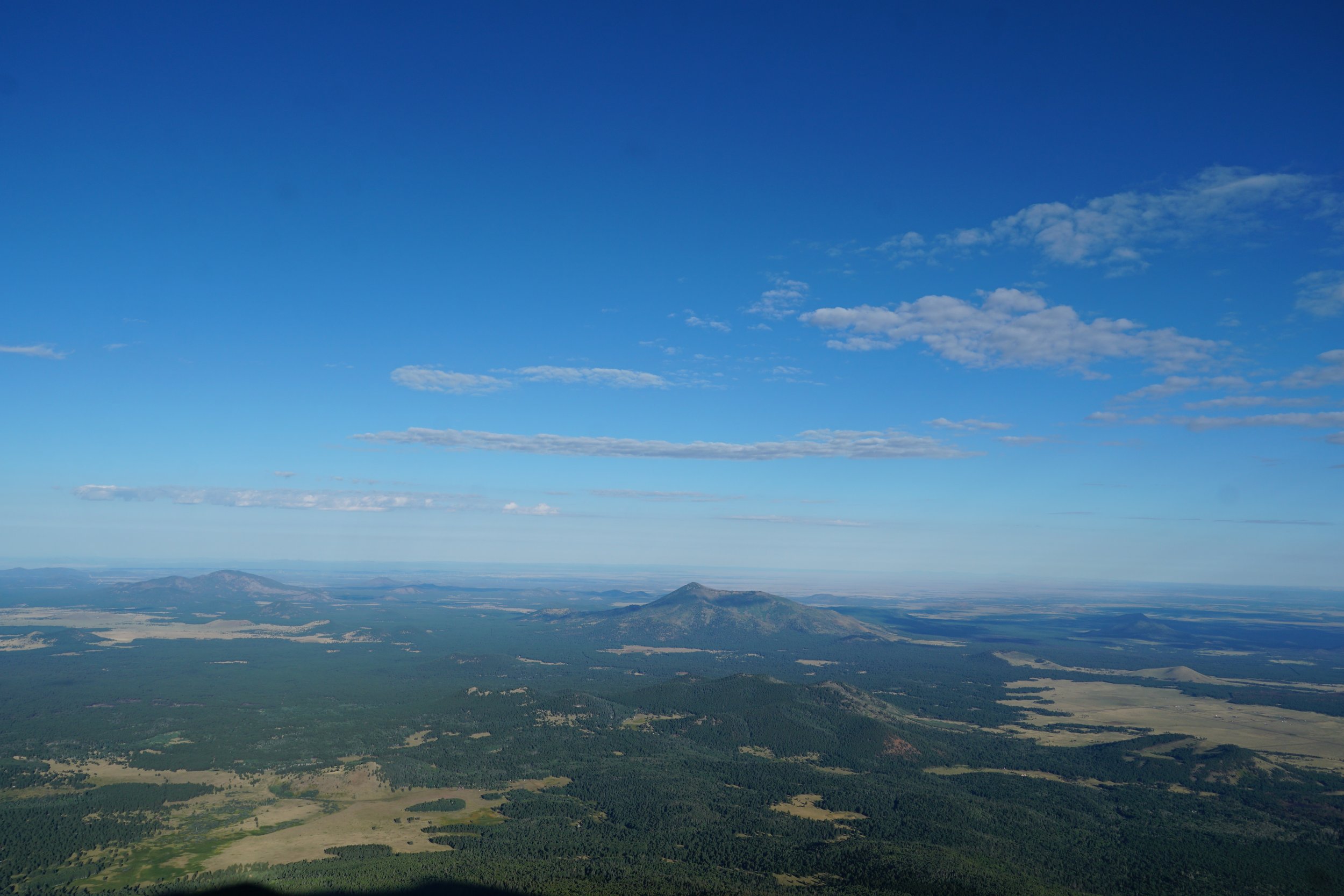
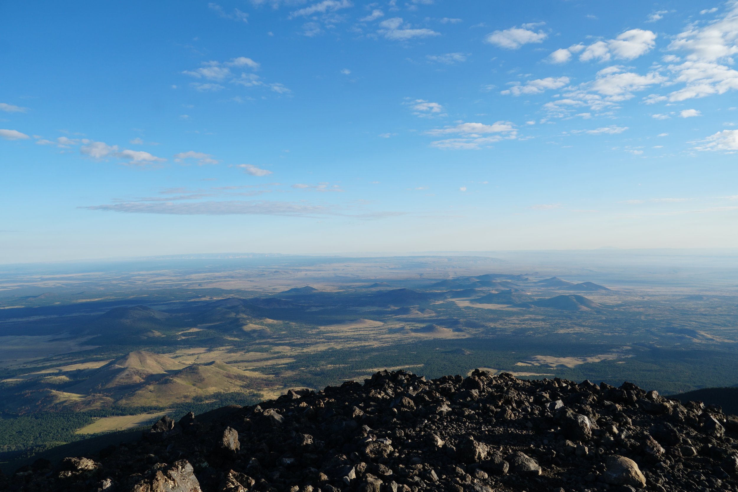
The summit offers jaw dropping views of the San Francisco Peaks and wilderness spreading as far as the eye can see. On a clear day, you can even see the Grand Canyon.
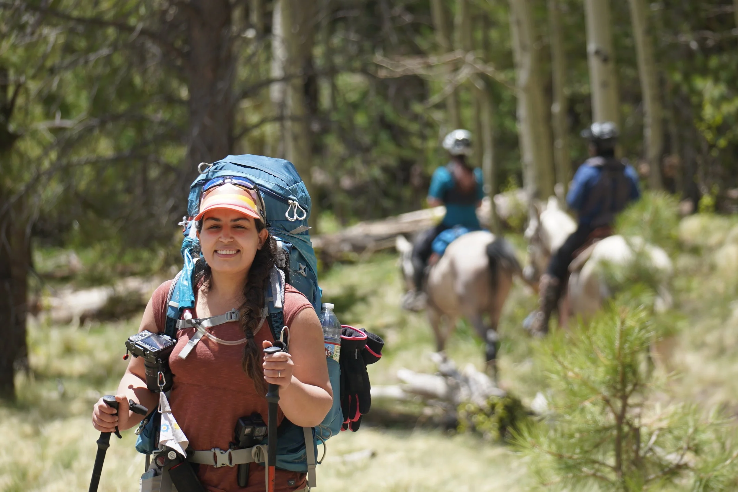
Having lived in Arizona for 5 years, I climbed Humphrey’s peak 3 times in different conditions and on different routes.
In this article, I will share with you things I learned from climbing this great mountain as well as some resources to help you make it to the summit and back, successfully and safely.

Close to the summit of Humphrey’s Peak right before the sunrise
About Humphrey’s Peak
Humphrey’s Peak is the highest peak of The San Francisco Peaks, a dormant volcanic mountain range in north central Arizona, just north of Flagstaff.
The San Francisco Peaks are the remains of an eroded stratovolcano and a remnant of the former San Francisco Mountain.
The name San Francisco was given to to the peaks to honor St. Francis of Assisi way before the city of San Francisco was named. Pretty cool!
In Navajo, the mountain’s name is Dookʼoʼoosłííd which means “its summit never melts”
The San Francisco Peaks are one of the four sacred mountains for the Navajo. According to the Navajo, the Holy People formed four sacred mountains that bordered the Navajo homeland : Blanca Peak in the East, Mount Taylor in the South, the San Francisco Peaks in the West, and Mount Hesperus in the North.
Why is it called Humphrey’s peak?
Humphrey's Peak was named in 1870 after Arizona General Andrew A. Humphreys, a U.S. Army officer who later became Chief of Engineers of the United States Army Corps of Engineers.
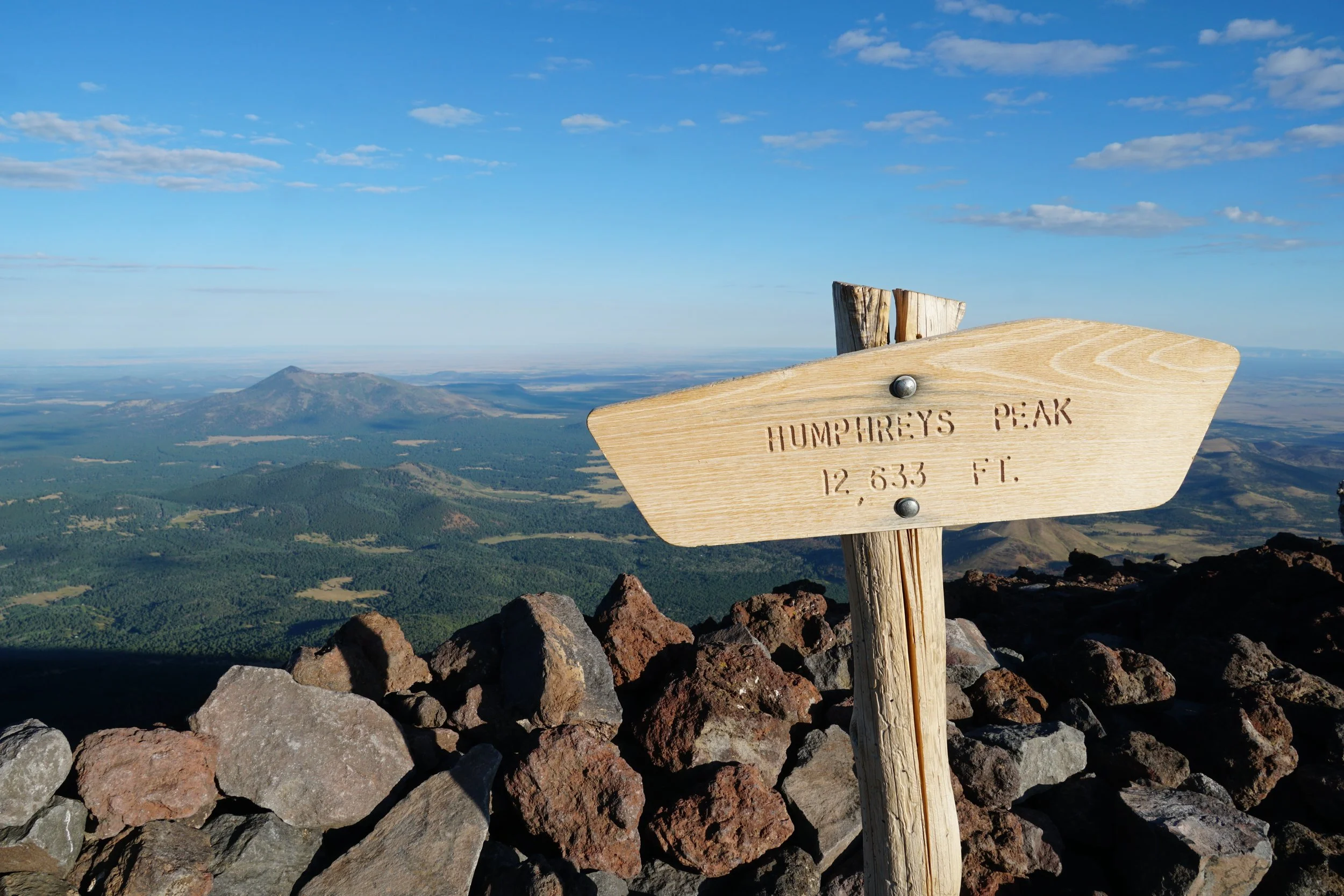
The sign at the summit of Humphrey’s peak 12,633 feet
How to get to Humphrey’s Peak?
To climb Humphrey’s peak, your adventure will start in Flagstaff, Arizona.
If you are making your way to Flagstaff from Phoenix, the best way to get there is by driving. If driving is not an option for you, you can use:
Shuttle transport from Phoenix Sky harbor to Flagstaff https://groometransportation.com/flagstaff/?&sd_client_id=e7df267c-85bb-441a-b3b9-89761b63a175 I took the shuttle up to Flagstaff for my first climb and I paid $90 for a round trip
Flixbus is a cheaper option but they have a limited schedule.
Where to stay in Flagstaff?
There are plenty of places to pick from in and around Flagstaff. Here are some of my favorites:
For free dispersed camping, I camped at Cinder Hills OHV Area . It’s a decent location but it can get crowded during the busy season
Ski Lift Lodge & Cabins: This lodge is very close to the Ski lifts at the Arizona Snowbowl as well as the trail head. You can call them at Phone: (928) 774-0729 to check availability
Americas Best Value Inn & Suites Flagstaff: This modern motel style place was my favorite. Very affordable, clean and close to the trail head https://www.redlion.com/az/flagstaff/americas-best-value-inn-suites-flagstaff
What’s the best time to climb Humphrey’s peak?
Humphrey’s peak is open for climbing year round. The most popular months are June to October.
For the average hiker and for better chances of a successful climb, the best months to climb Humphrey’s peak are June, September and October.
The Monsoon Season
In northern Arizona, the monsoon season starts around the beginning of July and can continue up until the end of September.
If you’re not familiar with the term “monsoon”, it describes large-scale wind shifts that transport moist tropical air to dry desert locations such as Arizona.
The monsoon season in Arizona comes with higher humidity, that can lead to thunderstorms, heavy rain, lightning, flash flooding and dust storms.
My first monsoon in Arizona felt surreal as I never expected heavy rains during summer in a dry desert.
On Humphrey’s peak, the risk of thunderstorm and lightning is higher this time of the year.
Before you climb Humphrey’s peak during the monsoon season, make sure to check the weather forecast and plan to make your way down from the summit before noon ( I will talk about this in details later on)
Humphrey’s Peak in May
Climbing Humphrey’s peak in May is possible but it can get really difficult. In May, the snow is still deep, you will most likely need crampons or even snow shoes in some sections.
With deep snow, the trail is not very well marked which makes navigation difficult.
I climbed Humphrey’s peak in May 2019 and it was one of the hardest climbs I have experienced at that time. There was a lot of snow on the trail that we ended up losing the trail multiple times.
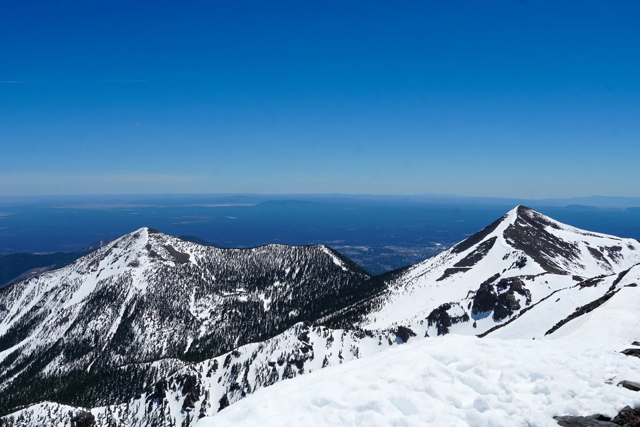
Humphrey's Peak in May
Climbing Humphrey’s Peak in Winter
Climbing Humphrey’s peak during winter is a unique adventure.
To climb Humphrey’s peak during winter, you need a backcountry permit. This permit is free and can be obtained during the weekend at the Agassiz lodge at the Arizona Snowbowl, where you will be briefed on winter safety on the mountain and risk of avalanche.
These permits are required to help with search and rescue if necessary.
Unless you are an experienced hiker or mountaineer, it’s not the best idea to attempt this mountain during winter.
You will most likely need crampons and/or snowshoes depending on the snowfall during the winter season.
Before you attempt this climb in winter, read more about avalanche and winter safety in the Coconino National Forest.
Humphrey’s Peak Hiking Trails
There are 3 different ways to get to the top of Humphrey’s peak:
The Humphrey’s Peak trail:
The Weatherford Trail
The Inner Basin trail
Humphrey’s Peak Trail
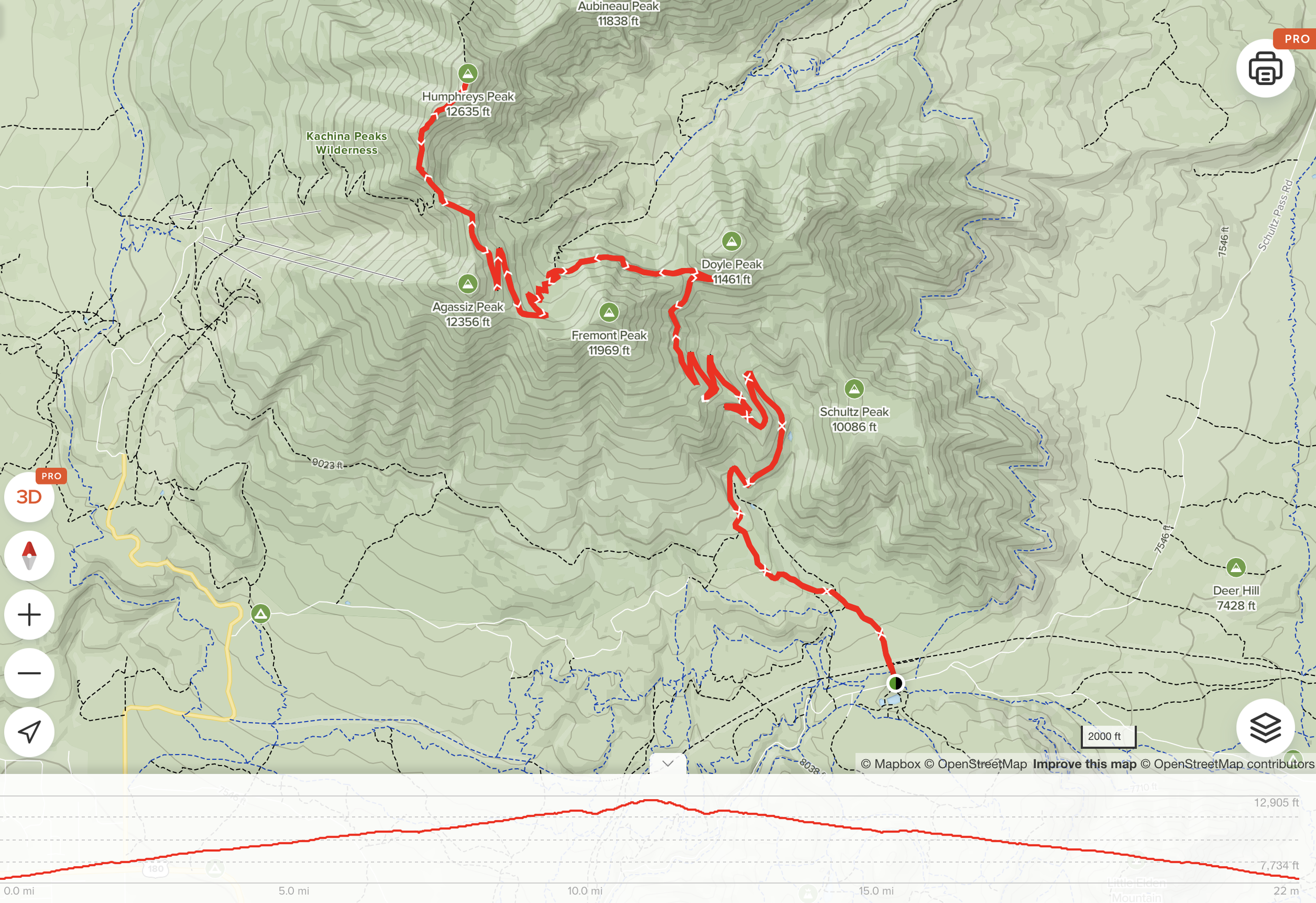
This is the most popular trail to get to the peak. Humphrey’s peak trail is about 10 miles long out and back with an elevation gain of 3,395 ft. It takes from 5 to 8 hours to get to the summit and back. It can take longer depending on your pace and the number of brakes you are taking.
The trail starts from the Arizona Snowbowl where you can park your car and start your adventure.
If you are not starting super early (before the sunrise) there are usually park rangers at the trailhead. You can ask them about general information and conditions on the mountain.
The trail map from AllTrails is accurate and useful to help with navigation.
I like to split this trail in my head to 5 different sections:
Lower switchbacks (N 1-6 in the map)
Crossover
Upper switchbacks (N 7 in the map)
The saddle (Number 9 in the map)
The push to the summit

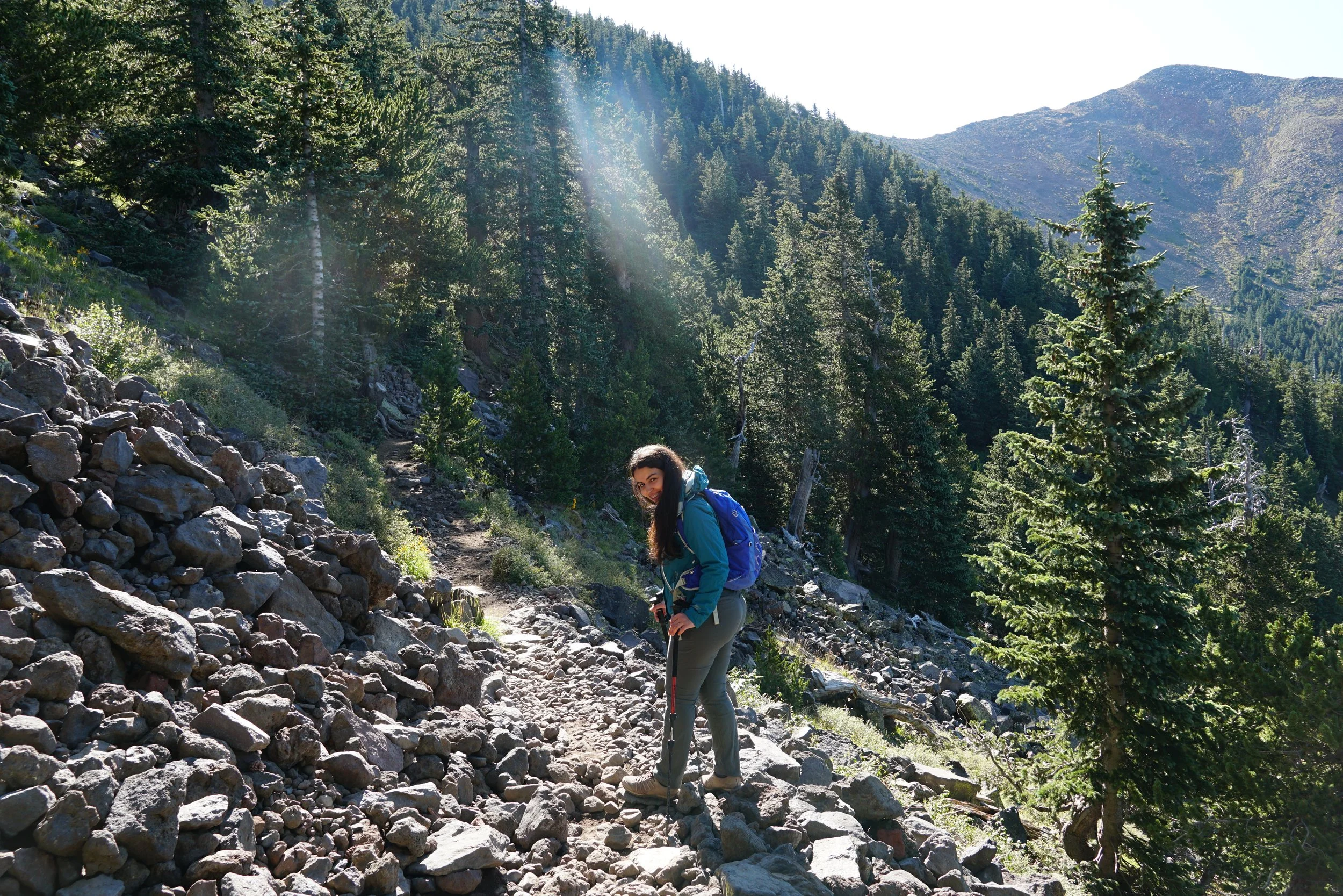
Humphrey’s peak trail
You start hiking through a grassy meadow from the Arizona Snowbowl on a pleasant leveled trail.
Soon after, you make your way inside the ponderosa pine forest. During summer, this section of the trail is well marked and easy to follow.
After about half a mile, you enter the Kachina Peaks Wilderness boundary where there is a sign and a registration box. If there is a registration box at the time of your visit, be sure to enter your information. This usually helps with statistics about foot traffic on the mountain as well as search and rescue if necessary.
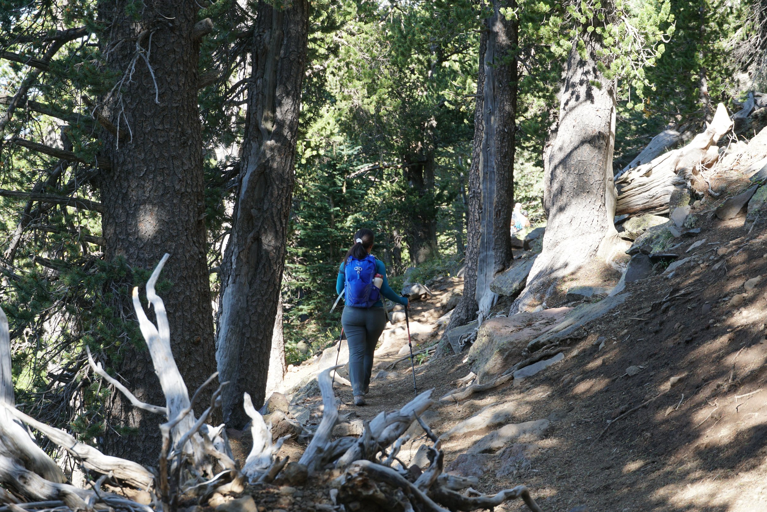
About half a mile after entering the wilderness zone, you will start tackling the lower switchbacks.
The switchbacks feel like they are never ending but this is just the beginning. There are plenty of rocks and roots on the trail so pay attention to your footing.
After you finish the lower switchbacks, you’ll start hiking a “crossover” (From point 6 to 7 on the map) at around 11,000 feet climbing your way above the tree line.
You will continue pushing until you get to the upper switchbacks and push to the saddle. The elevation at the saddle is about 11,800 feet.
The saddle is a good spot for a longer break (if the weather permits) and it’s also a good checkpoint to determine if you are able to push to the summit.
From the saddle up, the trail becomes steeper, rockier and you are now fully exposed. Make sure that you pack a windbreaker.
This trail is notorious for its two false summits. Don’t get two excited, there’s still hard work ahead.
During summer, this section of the trail is easy to follow but in winter it can get tricky. There are, However, a number of wooden markers that can help you find your way up.
After the second false summit, you are 20-30 minutes from standing at the highest peak of Arizona “Humphrey’s peak”. The summit is open to jaw dropping views of the Kachina Peaks Wilderness and the San Francisco Peaks. Take a moment to take in the views and take a photo at the popular wooden sign.
Can I camp on Mt Humphreys?
There is no camping above the treeline (11,400 feet). You may camp below the treeline, but you cannot camp within Snowbowl boundaries.
The Weatherford Trail
A less popular route to get to Humphrey’s peak but it has so much to offer and it’s less crowded.
The Weatherford Trail was once a road that allowed Model T Fords to get up to 12,000 Feet.
I remember seeing remains of a vehicle on the side of this trail but I am not quite sure it was an actual Model T Ford.

Remains of a vehicle on the Weatherford Trail
The Weatherford Trail to Humphrey’s peak is longer, more strenuous but the views are just incredible. The trail to the peak and back is 22.3 miles long with an elevation gain of 5,242 ft.
This trail is surrounded by all the major San Francisco Peaks (Fremont Peak, Agassiz, Doyle and Schultz)
It’s also a popular route for backpackers attempting the Kachina Peaks Wilderness Loop which is an incredible backpacking adventure.
The Inner Basin Trail
The Inner Basin trail connects to the Weatherford Trail and continues to Humphrey’s peak. This is a less common route to approach the peak.
How hard is Humphrey’s peak?
Humphrey’s peak is not an easy climb. It’s a strenuous and demanding hike, both physically and mentally but it’s absolutely worth it if done right.
What to pack for Humphrey’s peak?
In addition to packing the 10 Essentials for hiking, here are a few more things to take into consideration.
Pack Enough Water
There is no reliable water source on Humphrey’s peak trail. You have to pack your own water.
For this hike, I packed 4 liters of water. 3 liters in my Osprey hydration pack and about one liter in my nalegene water bottle.
Pack Enough Snacks for the Trail
It’s important to stay hydrated and nourished on the mountain, pack your favorite snacks both salty and sweet. Here are some of my favorites.
10 Safety Tips on Humphrey’s Peak
Let Someone Know Where You Are Going
Let a friend, a family member or a partner know where you are going and how long you plan on being outside. If you are hiking solo, make sure you have a satellite communicator in case of emergencies.
Check the Weather Forecast
It’s always important to check the weather forecast even before you commit to your climb. I like to use mountain forecast for accurate predictions on the mountain. The weather on the mountain might be very different from where you start. Don’t rely on the weather forecast in Flagstaff.
Pay attention to any upcoming storms, snow or visibility on the mountain.
Start Early
There are many reasons why it’s a good idea to start early:
You can find parking easily especially during the busy season
Less hikers on the trail before the sunrise
You have enough time to make it to the summit and back before afternoon storms
You give yourself time to take breaks as necessary
You don’t have to hike in the dark on the way down